Planning for 670,000 more people
The Greater Adelaide region spans 11,000 square kilometres, stretching south to Cape Jervis, west to Murray Bridge and north to Port Wakefield.
It’s home to about 1.1 million people — about 85 per cent of South Australia’s population.
That population is predicted to grow by 46 per cent to 2.2 million by 2051, requiring an extra 315,000 homes and 254,000 jobs.
Brett says planners started with those population projections, working back to determine how many homes would be needed and then mapping out where they would go. The goal was simple in principle, if not in practice.
"We wanted to make sure we don't get caught short in terms of having a 15-year rolling pipeline of land and homes for people," Brett says.
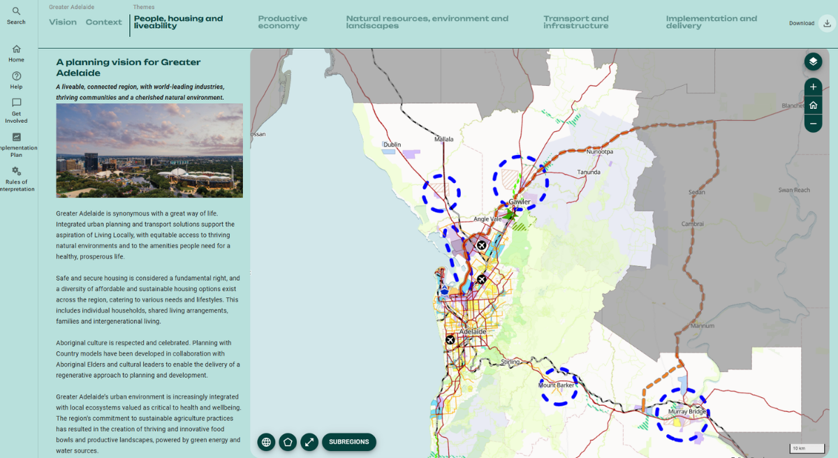
The team had a head start in one respect. After major digital planning reforms between 2016 and 2021, SA was already the only state with a fully online planning and design code.
The Greater Adelaide Regional Plan became the “last piece of that puzzle”, Brett says, taking long-term strategic planning digital for the first time, and making detailed, evidence-based information accessible to everyone.
It’s also integrated with South Australia’s award-winning digital Land Supply Dashboard, which tracks land availability and housing targets in real time.
A transparent plan that saves time and money
Creating the online plan was a major undertaking, bringing together planners, technology specialists and experts from multiple state agencies to develop a single, consistent view of how Greater Adelaide might grow.
A core part of that work was mapping hazards. Flood-prone land, climate change projections and areas of high environmental value were layered into the plan, helping ensure future homes, schools and hospitals are not built in risky places.
Transparency was also a key goal.
"In the traditional model of strategic planning, you’d have a fuzzy book that gives some principles and some fuzzy maps, and that was about it," Brett says.
"Then councils or landowners would commission a bunch of work on a range of issues to understand: is it flood-prone, how will climate change affect this, what are the government's plans for services? Just a whole raft of investigations."
The new platform was built to make that kind of costly, time-consuming duplication unnecessary.
"The core principle was to avoid that as much as possible and be more high-fidelity in terms of the information," Brett says.
"People can access richer data to make decisions up front. You’ve got the baseline there, you don’t have to commission that work — it saves time and money."
Because it's fully digital, the Greater Adelaide Regional Plan can be updated as new information comes to light, ensuring government, councils, developers and communities are all working from the same assumptions.
Ensuring new suburbs are well serviced
Beyond the digital maps, the Greater Adelaide Regional Plan sets out policies that change how growth will be delivered, addressing longstanding gaps in the way new communities are planned.
Rather than rezoning land and leaving infrastructure coordination to others, the state will now take the lead on major growth areas — working with councils and the private sector to ensure adequate schools, healthcare and transport are provided as communities develop.
"We'll do high-level structure planning to guide how new suburbs develop, making sure we reserve land for things like social infrastructure, before rezoning and handing over to the private sector,” Brett says. “They can then develop their sites within that broader framework."
Housing targets have also been allocated to each council across the Greater Adelaide region.
But rather than applying an arbitrary percentage across the board, the targets are tailored to the unique conditions of each council area — including its constraints, heritage overlays, environmental sensitivities and development opportunities.
Councils will continue to lead on local infill opportunities, Brett says, working with their communities to determine where and how housing targets can be met, and planning the local infrastructure — parks, footpaths, community centres — to support them.
Making room for a diversity of housing types
Adelaide's housing mix has long been dominated by detached family homes.
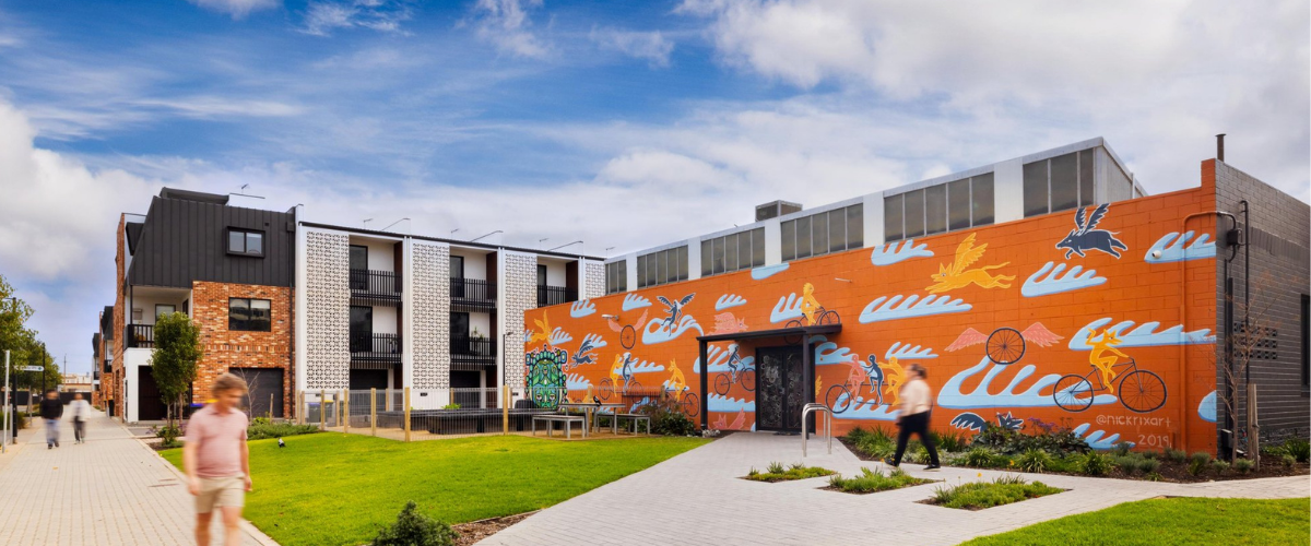
Medium-density options, such as townhouses, are already permitted in many areas, but the Greater Adelaide Regional Plan pushes further, encouraging housing types not often seen within the local market.
That includes apartments, lower-rise walk-up flat buildings, and what the plan calls ‘ancillary accommodation’ — granny flats and other self-contained dwellings on existing residential blocks that could house a young person or elderly parent.
“We want to provide a range of options at different price points to cater for the diversity of people who are looking for a home, including singles, older people downsizing and people with high needs,” Brett says.
To make these diverse housing types a reality, the state's Planning and Design Code will be amended to formally introduce them.
That's one of 52 staged actions set out in the Greater Adelaide Regional Plan, each assigned to a responsible party and tracked publicly through the plan's rolling five-year dashboard.
Protecting the environment and creating more green space
During public consultation in 2024, protecting biodiversity emerged as one of the community’s highest priorities.
The plan commits to achieving 30 per cent tree canopy cover across metropolitan Adelaide by 2055, and protecting 88 per cent of the region's food production areas, including the Barossa Valley, Adelaide Hills and McLaren Vale.
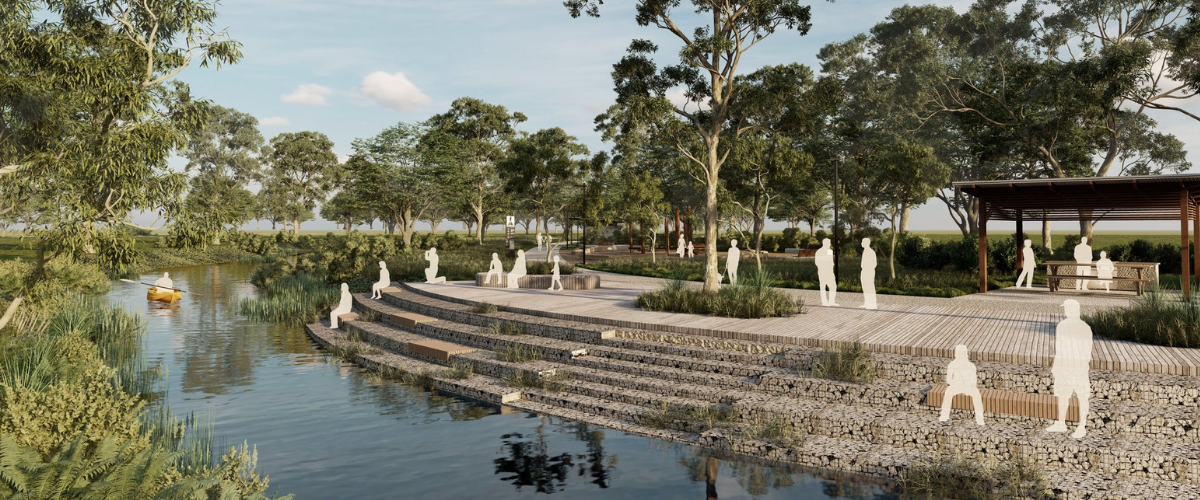
But perhaps the most ambitious initiative is the Northern Park Lands — a new regional open space network comprising parks, trails, recreation areas, and restored natural landscapes and waterways for Adelaide's rapidly growing northern suburbs.
In the 1960s, much of this landscape was identified as part of Adelaide’s Metropolitan Open Space System. However, large areas remained privately owned and inaccessible to the public, limiting opportunities to establish a connected open-space network.
The Greater Adelaide Regional Plan refined this corridor to better align with existing public land while maintaining its long-term strategic purpose. This allows revegetation, recreation and public access to begin immediately through the Northern Park Lands Trust.
"This is one of the most significant investments in public open space in South Australia’s history," Brett says.
"You’d have to go back to the River Torrens Linear Park to find an open space project of comparable scale. The Northern Park Lands will reshape how people connect with nature and each other across Adelaide’s northern suburbs for generations to come."
The Northern Park Lands Master Plan is currently being developed to guide the long-term planning, design and delivery of the network, with a draft expected to be released for community consultation later this year.
Designing communities where daily life is close to home
Woven through the plan is a principle called Living Locally — the idea that new communities should be designed so residents don't have to travel far for the things they need most.
"The expectation is that you'll have good, convenient access to education, healthcare, shops, parks and recreation, and access to employment either within your community or connected to it," Brett says.
"There are significant social benefits, as well as economic and environmental benefits — reducing time in cars, less demand for roads and infrastructure. It benefits the individual and the broader community, too."
A nation-leading plan for more homes, better placed
Since the plan launched in 2025, anyone can go online, search for their property or any address in Greater Adelaide, and see the long-term directions for that land.
That kind of accessibility — once unthinkable in strategic planning — has attracted interstate and international attention. Brett hopes such transparency will soon become the norm in planning.
"Governments historically have taken two bites at the cherry: giving a bit of certainty, then talking to people about the details later, rather than just being open and speeding up those conversations,” he says.
"Our overall aim is better coordination so we can all work towards the same goal and achieve more effective and faster delivery of homes and services. Everyone gets a better outcome in terms of development certainty, housing affordability and communities that are better to live in."